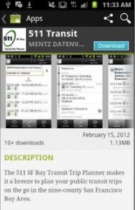
511 Transit app now available for iPhone

The San Francisco Bay Area’s award-winning 511 traveler information system has released the iPhone version of its comprehensive transit trip planner app. The free 511 Transit App, designed for use on the iPhone 4, uses GPS to efficiently plan and map trips on more than 30 Bay Area public transit agencies. The new iPhone app comes on the heels of an Android version that was released on February 22.
“What makes this app so powerful is that it helps travelers adjust their trips while on the go, even in unfamiliar areas,” said Adrienne J. Tissier, chair of the Metropolitan Transportation Commission (MTC). “It’s ideal for helping both residents and visitors plan transit trips, whether for errands, occasional trips or daily commutes. It uses GPS to show your location on a map in real-time and offers accurate route and schedule information from all transit operators in the nine-county region. The app’s coverage and functionality are unprecedented here in the Bay Area.”
The free 511 Transit App can be downloaded through the iPhone App Store using an iTunes account and by searching for “511 Transit.” The version for Android phones is also available on Google Play (formerly called Android Market).
“511 customers plan more than one million transit trips each month using the website version of the 511 Trip Planner,” said Tom Spiekerman, 511 Transit project manager. “We are pleased to offer this iPhone version of the 511 Transit App. It provides a fast, compact, and convenient trip planning tool for customers and supports our increasingly mobile lifestyles.”
The app provides door-to-door transit trip planning and scheduled departure times for transit routes near users’ locations or from locations they specify. It includes information for 720 routes and more than 23,700 transit stops throughout the region. An interactive, dynamic map shows routes and stops along the way, as well as one’s current position while on the move. Walking directions to and from stops and fares (including transfers) are also displayed.
ADVERTISEMENT
The app gives Bay Area transit riders current, detailed transit information and the confidence to access the Bay Area’s wealth of transit resources, which can be a valuable money saver during these times of rising fuel prices. It uses GPS to show a rider’s current location and nearby transit stops and stations on a map. Just a quick tap on the iPhone screen reveals nearby scheduled departure times and much more, all accessible while en route. The app is much faster and more convenient than referring to paper schedules or other mobile tools, especially for trips involving more than one transit operator.
The new app complements numerous options people already have to access 511 traveler information. Smartphone and other mobile phone users may access many of 511’s most popular features through the mobile 511 site (m.511.org), by calling 511 from any Bay Area phone or by receiving real-time transit Departure Times texts (SMS). Desktop users can access the information from 511.org.
511 Transit App customers are able to provide feedback on the new app by clicking on the “Info” button to send an email to the 511 Team. Plus, 511 encourages customers to rate both versions of the app in the iPhone App Store and through Google Play (the Android Market).
The 511 Transit App includes data from SF Muni, BART, AC Transit, VTA, SamTrans, Caltrain, Golden Gate Transit, County Connection, Vallejo Transit, LAVTA, Sonoma County Transit, VINE (Napa County) and more than a dozen additional agencies. For a complete list of all transit agencies included in the 511 Transit app, please visit the transit page at 511.org. A fact sheet about the new app is also posted on the MTC website.

